San Jose, Occidental Mindoro
(Source : WikiPedia, the free encyclopedia)
San Jose is a first-class municipality in the province of Occidental Mindoro, Philippines. According to the 2010 census, it has a population of 131,188 people.[3] San Jose is the economic, financial, cultural, and educational center of the province of Occidental Mindoro. It has the largest commercial port and airport in the province. It is named after its patron saint, St. Joseph, the husband of Mary. Most of the people are Visayans, Batangueños and Ilocanos.
Mamburao to the north is the official capital of the province, but most provincial government offices have satellite offices in San Jose. The town also has the most number of business and commercial establishments in the province, and is either the major market or transit point for agricultural and commercial products. Major banks includePhilippine National Bank (PNB), United Coconut Planters Bank (UCPB), Development Bank of the Philippines(DBP), Allied Bank, Metrobank, Landbank, and Philippine Veterans Bank.
Telecommunication services are provided by Digital Telecommunications (Digitel), Smart Communications, and Globe. Cable and satellite television operators provide access to local and international broadcasts. Broadband Internet services are likewise available through the numerous internet cafes located in the poblacion area.
Large public and private elementary and high schools provide basic education in the town proper and smaller barangays. Major educational institutions in the province include Occidental Mindoro State College (OMSC), Divine Word College (DWC), Montessori de San Jose, Philippine Central Islands College (PCIC), I-NET Asia Technological School, Inc., Southwest Philippines Ecumenical School Inc., and Abeleda Technical School.
The population growth currently experienced by San Jose is attributed to a growing number of migrants fromPalawan, Southern Luzon, and Visayan provinces.
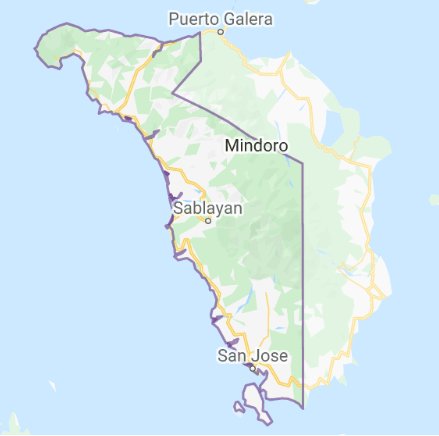
Geography
It is located at the southern part of the province with a total land area of 44,670 hectares (110,400 acres).[2] Climatic condition is classified under Type A category and slope is generally flat. Soil composition developed from recent alluvial deposits which are silty-loam to clay loam and landforms consist of limestone and sedimentary rocks. All types of erosion are present: slight, moderate and severe erosion. Eleven (11) rivers and creeks serve as natural drainage. Mineral deposits includes copper and limestone.
- Ambulong
- Ansiray
- Bagong Sikat
- Bangkal
- Barangay 1 (Pob.)
- Barangay 2 (Pob.)
- Barangay 3 (Pob.)
- Barangay 4 (Pob.)
- Barangay 5 (Pob.)
- Barangay 6 (Pob.)
- Barangay 7 (Pob.)
- Barangay 8 (Pob.)
- Batasan
- Bayotbot
- Bubog
- Buri
- Camburay
- Caminawit
- Catayungan
- Central
- Ilin Proper
- Inasakan
- Ipil
- La Curva
- Labangan Iling
- Labangan Poblacion
- Mabini
- Magbay
- Mangarin
- Mapaya
- Murtha
- Monte Claro
- Natandol
- Pag-Asa
- Pawican
- San Agustin
- San Isidro
- San Roque
History
Historical records show that in 14th century, Chinese traders anchored to trade at the shores of Mangarin, the oldest settlement in the southern portion of Occidental Mindoro. Its name was derived from the word “Mandarinâ€, an official Chinese Palace, the remains of which can still be found in the old barrio of Mangarin. When the Spanish took possession of the Island in the 18th century, the first site of the Presidencia was built in sitio of Sinaoga[citation needed], on the western side of Barrio Sta. Teresa, now part of the municipality of Magsaysay. A year later, it was again transferred to Caminawit. On May 1, 1910,[5] Pandurucan, which was renamed San Jose, became the seat of the Civil Government with Don German Ramirez as its first appointed leader up to 1915. When the Japanese Imperial Forces occupied the town, Bonifacio Gomez was appointed as Mayor from 1941-1942 followed by Pedro Cuden, 1942–1943 and finally Isabelo Abeleda in 1944 until 1946. During the American reoccupation Bibiano Gaudiel replaced Isabelo Abeleda who regained his position in 1955.
San Jose figures prominently in Philippine history for its role during World War II. American forces led by General Douglas MacArthur with the Filipino soldiers staged a so-called "Second Landing" in the beaches of San Jose (the "First" being the famous Leyte Landing) on December 15, 1944, to retake the Philippine islands from the Japanese (the Battle of Mindoro). Securing San Jose and the whole Mindoro island proved decisive in the goal to recapture Manila and Luzon, and the eventual defeat of the Japanese Imperial forces by Filipino and American troops.
The Philippine government split Mindoro into two provinces, Occidental Mindoro and Oriental Mindoro in 1950. San Jose became the temporary capitol but was transferred to Mamburao on January 1950. Migration to Mindoro in the years after the war boosted population growth and spurred development. The Philippine Sugar Mill plantation in the northern Barangay Central helped San Jose become the center of commerce in those years. The economic base has since widened to include rice, corn, tobacco, salt, and aquaculture production.
Economy
The municipality has diverse economic activities. However, the majority of the working force which is estimated at 76%, are still engaged in agriculture. Like the rest of the province, other industries in San Jose are tied to the town's agricultural base. A substantial majority of palay and rice of Occidental Mindoro, a major supplier of rice for Manila and elsewhere, are delivered, milled, traded and sold in San Jose.
Other major agricultural products include corn, garlic, onions, and root crops. Aquaculture is well-developed in San Jose which is known for its export quality lapu-lapu, bangus (milkfish), and sugpo (prawn). The town has abundant coastal and marine resources which provide an ample supply of fish and marine products for local consumption and exports.
Commercial livestock and poultry farms producing layers, broilers and meat products also exist. San Jose has a large number of agricultural support facilities such as rice mills, warehouses, solar dryers, and the like.
Registered commercial establishments number around 1,030 and the public market, the center of commercial activities, is the largest in the province. Other industries include hollow blocks making, handicrafts, furniture, sweet goods, and other small-scale processing and manufacturing plants.
Transportation
Most roads in the poblacion area and nearby barangays are concrete and/or asphalted. The major thoroughfares are Rizal Street, Liboro Street, Bonifacio Street, Mabini Street, and the streets in and around the public market. Tricycles are the common mode of transportation around town. Jeepneys provide the main mode of public transportation between San Jose and other towns of the province. Vans and sports utility vehicles (SUVs) are likewise numerous. The number of land vehicles in San Jose has grown because of the population boom starting in the early 2000s. Pump boats can be chartered to provide access to nearby island resorts and diving spots.
The town is served by the San Jose Airport, with regular scheduled flights to Manila by Cebu Pacific. Flights take approximately 30 minutes.
Several Bus Liners have a direct bus route from Manila, Pasay and Alabang to San Jose that includes a roll-on/roll-off ferry that operates between Abra de Ilog and Batangas City (a three-hour trip across the Verde Island Passage).
San Jose is linked to all towns of Occidental Mindoro via a well-paved concreted provincial highway that runs from north to south. Roads in and around San Jose are well-paved on mostly flat terrain. Local bus and jeepney operators ply the route from the northernmost town of Abra de Ilog all the way south to San Jose. From the San Jose Bus Terminal, travelers can ride a jeepney to Magsaysay, the last town of the province of Occidental Mindoro, and further across the mountains to Bulalacao, Oriental Mindoro via the newly constructed Roxas-Bulalacao-San Jose Road.